
Lands Design
for AutoCAD
BIM Professional Landscape Design
COMPATIBLE WITH


WORKS YOUR WAY
Your known commands,
now with specific landscape tools.
Lands Design installs as a plugin inside AutoCAD. Nothing changes,
you simply get professional landscape tools added to your existing workflow.
— TERRAIN —
Model any terrain,
grade it with precision
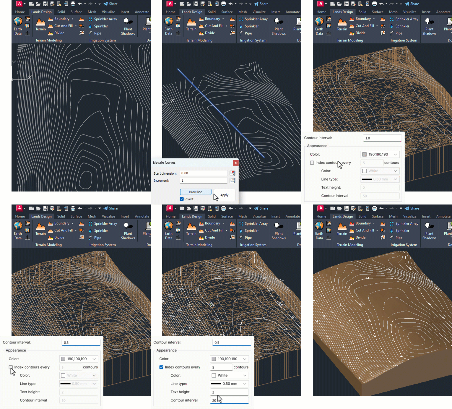
Create and edit terrain models with flexibility. Work on them as editable objects and analyze earthwork calculations to make informed decisions on every grading intervention.
Create Terrain from Curves or Points
Generate terrains from topographic contours, meshes and point clouds. Or import them directly from satellite maps, DEM or GIS files.
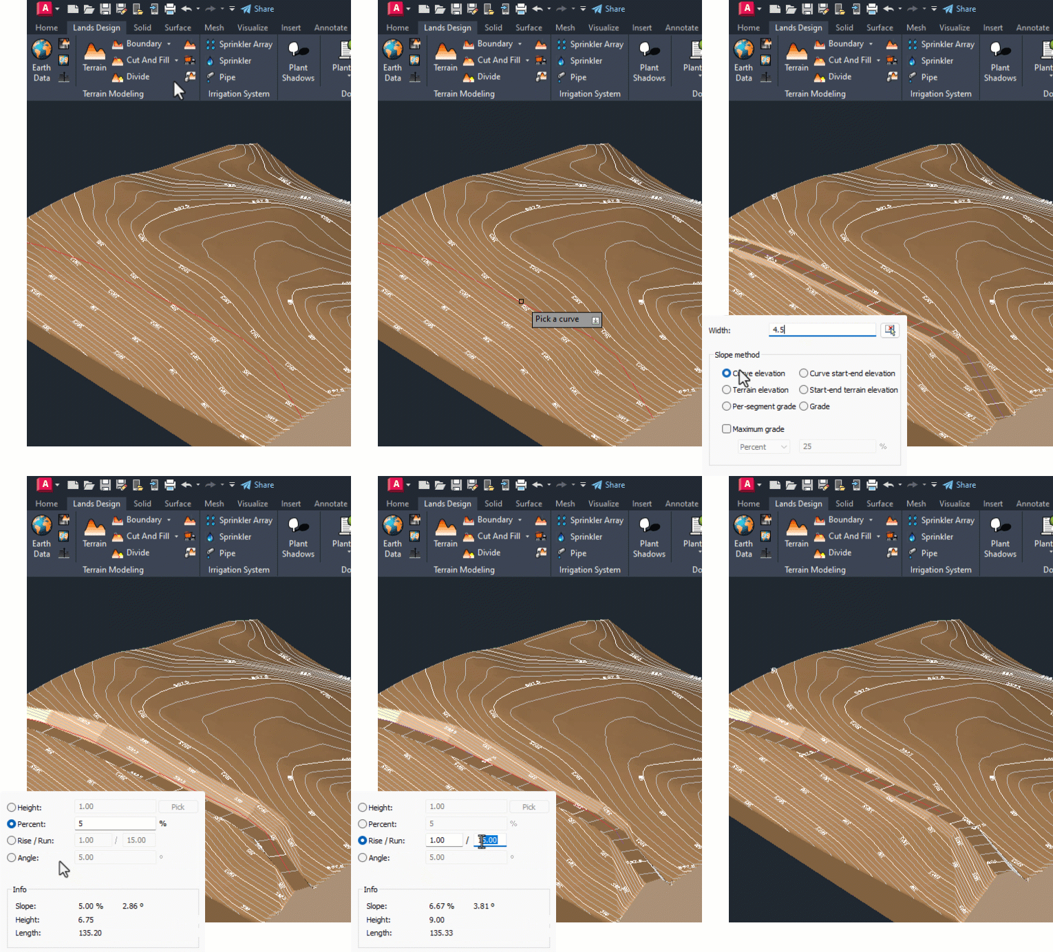
Grading Paths
Design paths with precise slope control. Define the gradient by height, angle or rise/run ratio. Or set a maximum slope and the geometry adjusts automatically.
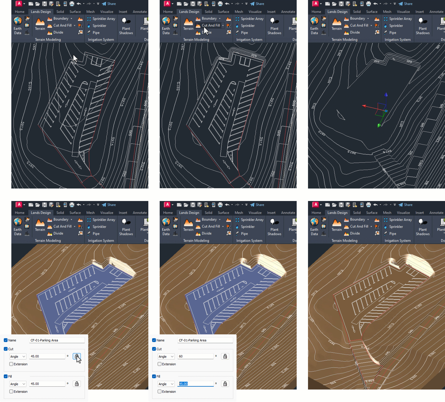
Cut and Fill Operations
Perform earthwork operations with full control over cut and fill angles. Operations are stored as editable objects, can be organized and sorted, and include automatic volume calculations.
— VEGETATION —
From plant selection
to documented
planting plan
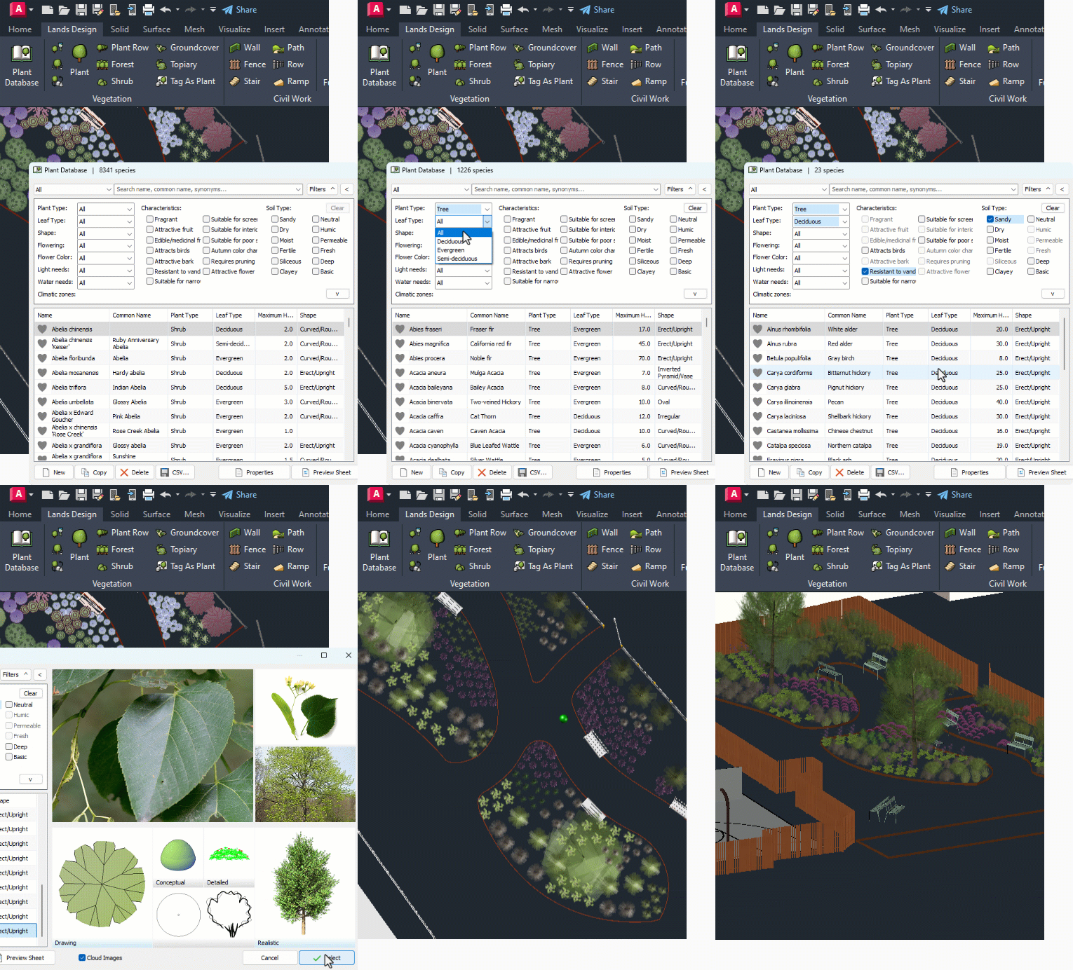
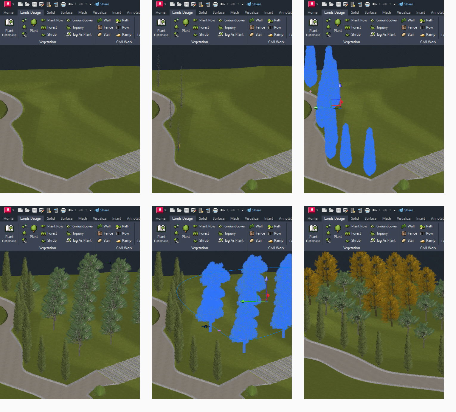
A filterable database of 8,000+ species with multiple plant representations, from 2D crowns to conceptual and realistic 3D. Adapt your visualization to every stage of the project.
8,000+ Species Plant Database
Filter by species type, climate zone, height, season and more. Each species includes full botanical descriptions, detailed 2D symbols and realistic 3D representations ready to use in your plan.
Multiple Insertion Modes
Plant individually, in rows, or in mass groups using the Forest tool. Define the species mix, density per m² and the distribution pattern for each area.
Topiary Art and Vertical Garden Tools
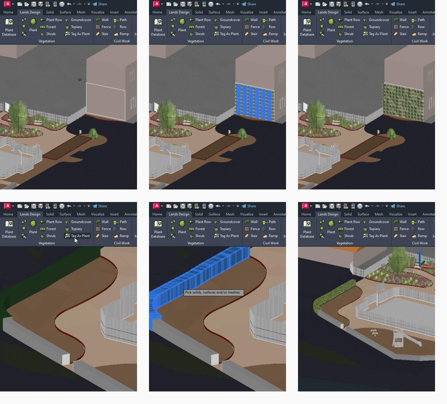
A dedicated selection of climbing and wall species lets you design green facades and vertical gardens directly in your plan. Or transform any 3D shape into topiary art using the Topiary tool.
DRAW IN 2D. WORK IN 3D
Everything you drew in 2D
already exists in 3D
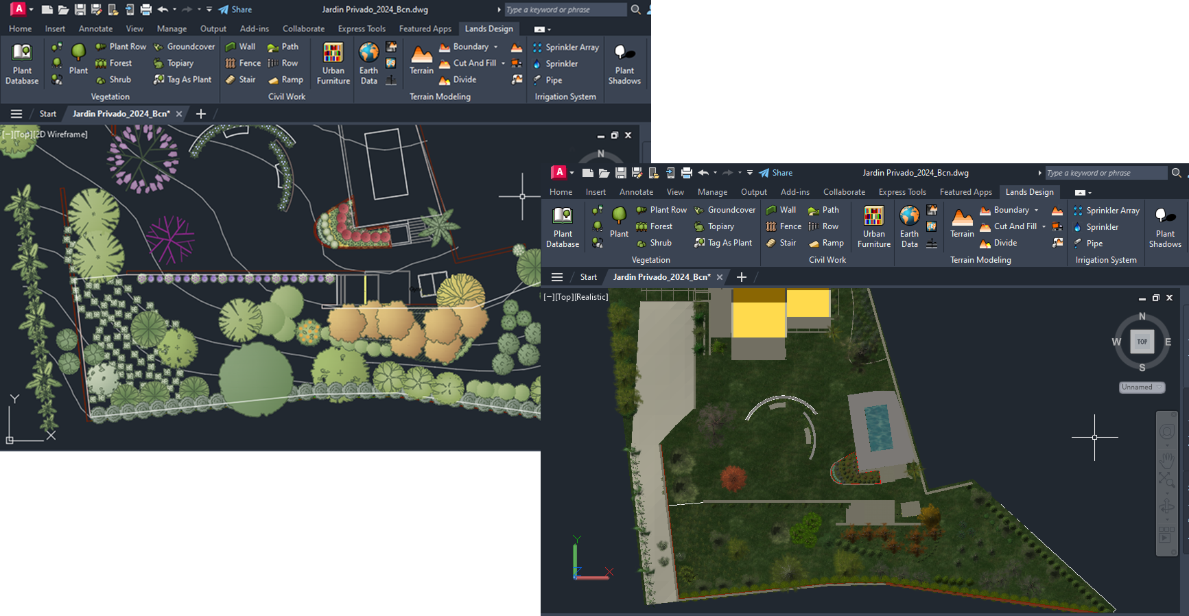
Every contour line, plant, path and wall you draw in 2D
builds a live 3D model at the same time. Switch views at any point in the process.
— HARDSCAPE —
Parametric walls, ramps and stairs drawn in your plan
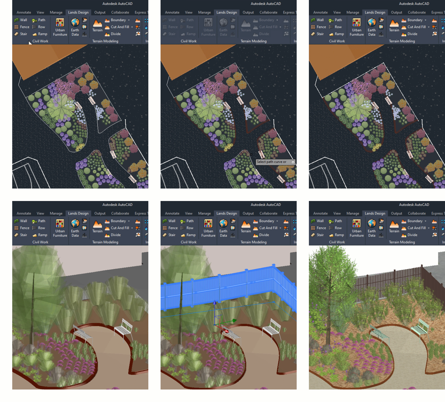
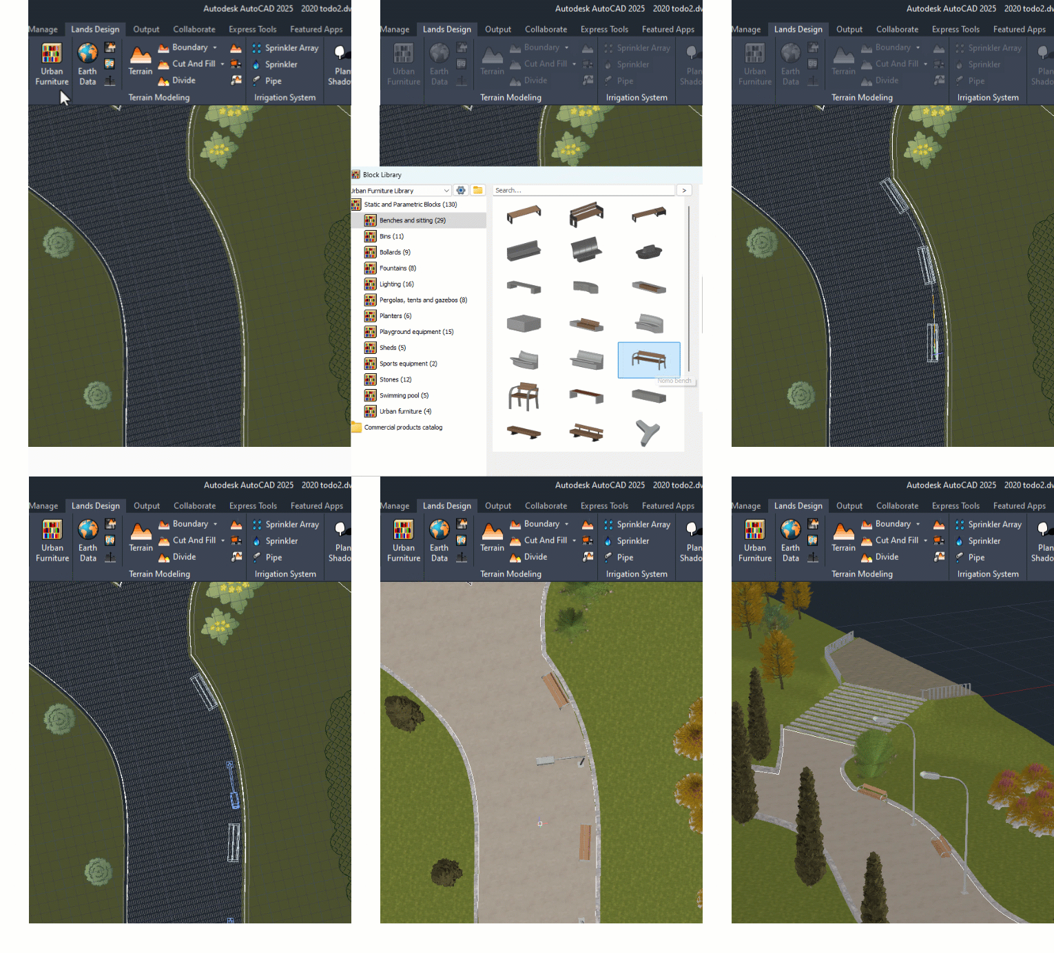
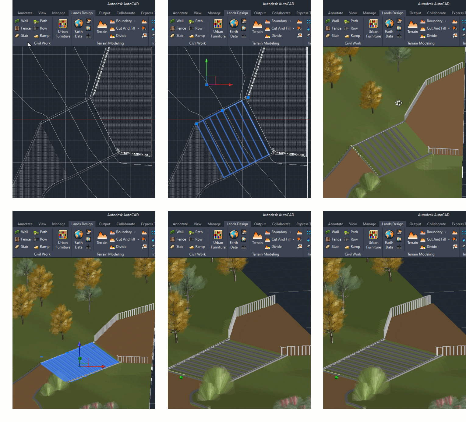
Design parametric hardscape elements directly in your 2D plan. Walls, ramps, stairs and urban furniture adapt to your geometry and generate their 3D representation automatically.
Walls and Fences
Create curved or straight walls, kerbs and fences to define boundaries, enclose spaces or add decorative elements to your design. Combine and distribute elements to achieve a wide range of styles.
Urban Furniture Library
Insert benches, lighting, bollards and more from a ready-to-use block library. Control distribution parameters for each element. Every object generates both its 2D and 3D representation automatically.
Ramps and Stairs from Curve
Create curved or straight parametric stairs and ramps from any polyline. Define rise, tread and slope and the geometry updates automatically.
— DOCUMENTATION —
Documentation that updates with every change you make
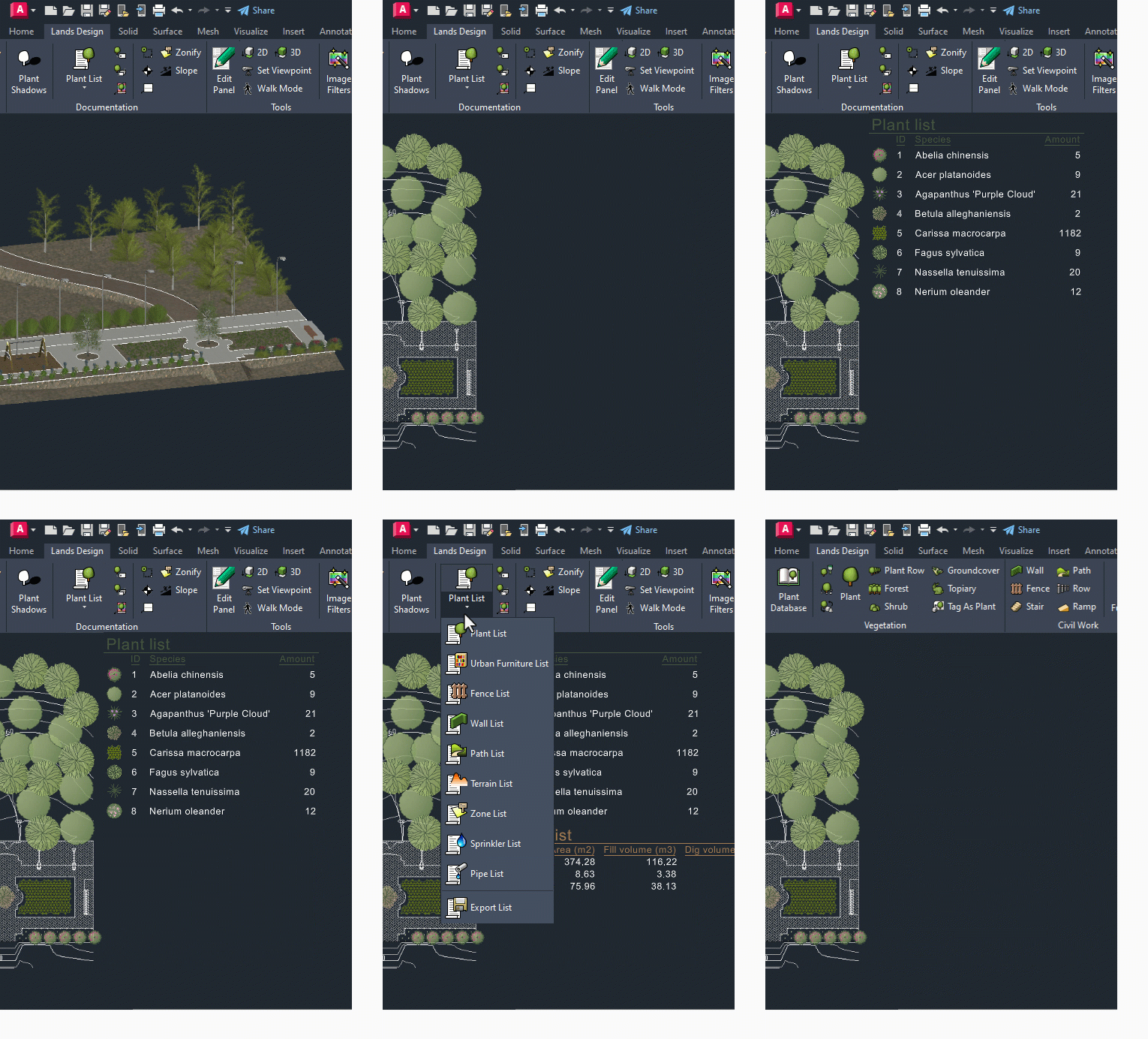
Every element you place feeds the project documentation automatically. Plants, walls, paths, furniture and terrain operations are always counted, measured and ready to export.
Automatic List Generation
Generate lists for plants, furniture, terrain, walls, paths, fences, irrigation and zoning directly from your plan. Lists update with every project change and export to Excel in one click.
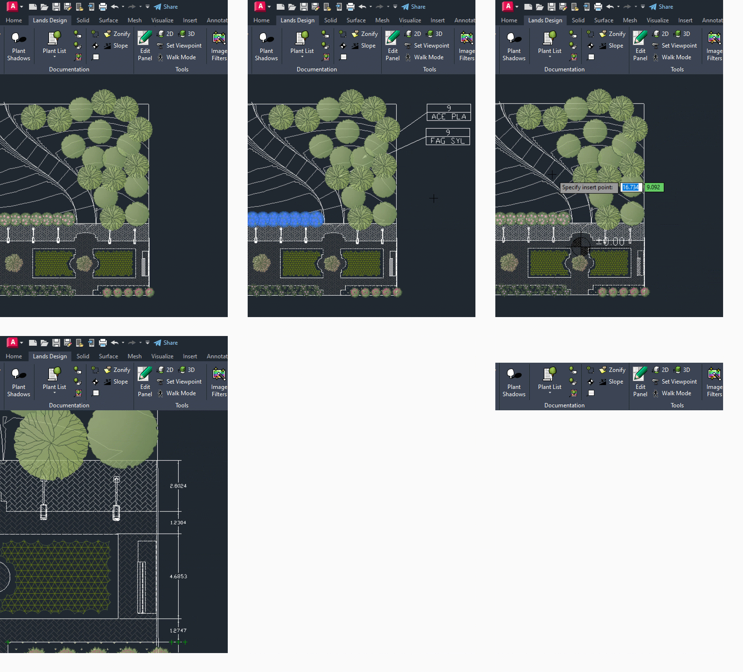
Drafting & Annotation Tools
Dimension your plan, mark slopes and elevations, and tag each plant species with its photo and name. All annotation tools are integrated into your drawing and update alongside your design.
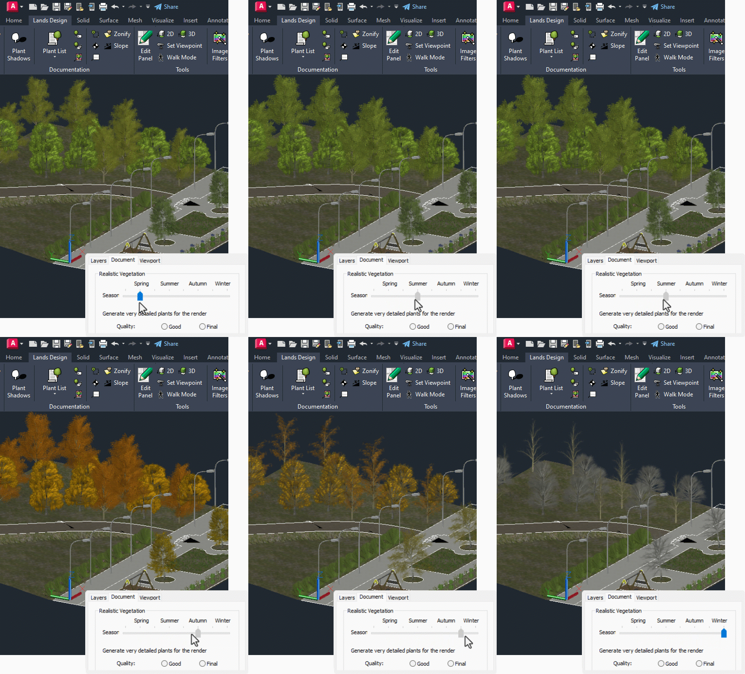
Seasonal Visualization
Preview how your planting design looks across different seasons. Each species adapts its representation to spring, summer, autumn and winter so you can evaluate the project at any time of year.
— PRICING —
Perpetual license.
Pay once, use forever
All versions include the complete plugin for AutoCAD and Rhino
Looking for upgrade or LAB license pricing? View all pricing options
Download and Start today
Add professional landscape design tools to the AutoCAD you already use.
Download the free 60-day trial and get started today.
Works with AutoCAD 2021-2026 · Windows · No credit card required
New users are eligible for a 60-day complimentary trial period.
A valid Rhino or AutoCAD license is required.
Lands Design offers a perpetual license.
A valid Rhino or AutoCAD license is required to run Lands Design. The same Lands Design license works on both platforms, and can be shared across your team
If you don’t have Rhino or AutoCAD, consider exploring RhinoLands license options instead.
Students and academics get a significantly discounted perpetual license. It stays valid after graduation, ensuring continued use of the software.
A valid Rhino or AutoCAD license is required.